Cairo on a Map Uncovered: How to Navigate Egypt’s Capital in 2026
Understanding Cairo on a Map: Location and Overview
Cairo is considered the capital of Egypt and is one of the major cities across Africa and the Middle East. If you look at it from an international viewpoint, the city appears as a large metropolitan region that lies on the Nile River.
Understanding the layout of Cairo is vital for visitors, as it isn’t an ordinary circular city. It is rather a stretch of the river, creating a vast and complicated urban layout that ties together multiple districts.
This guide provides information on Cairo’s geography, the major zones, the transport system, and the most popular tourist attractions in a simple and useful manner for navigators, along with travel planning.
📍 Geographic Location & Cairo Egypt World Map Position
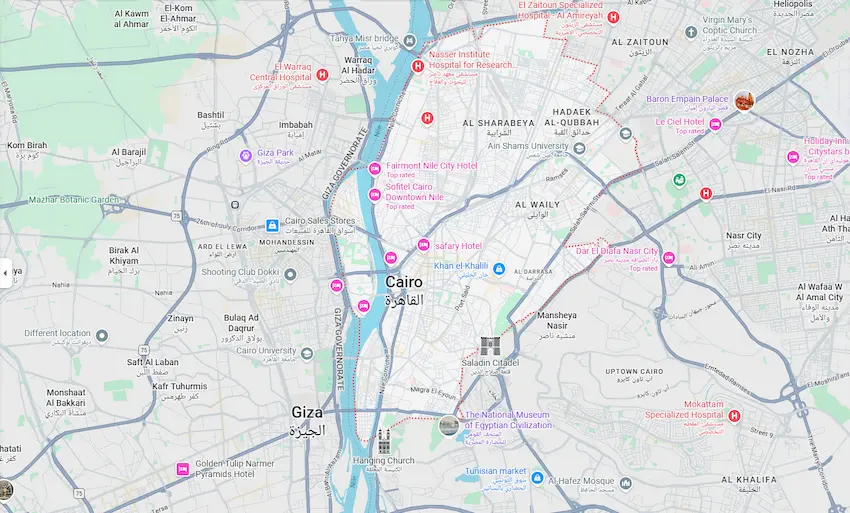
Cairo is in the northern part of Egypt, on the Nile River just south of the Mediterranean region. Its coordinates put it in an area of strategic importance that links Africa and Egypt, and the Middle East.
The river, which divides Cairo into western and eastern zones, impresses the city’s geographical layout. People have constructed most commercial and residential areas around this slender strip of fertile land.
Because of this design, Cairo has expanded longitudinally instead of outwards, creating a distinctive capital design in the world.
🌍 Looking at Cairo on Map of Africa & Regional Importance
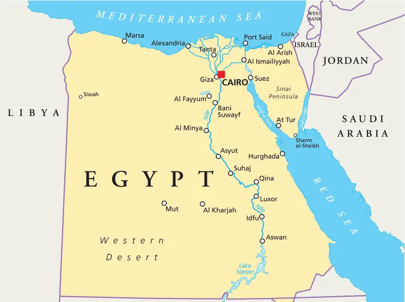
In the African continent, Cairo can be one of the most powerful and largest cities in terms of population, economy, and social activity. It is a major player in governance, trade, and cultural exchange.
The city serves as an intermediary connecting Africa, as well as a bridge between Africa and the Middle East, making it essential for regional transportation and political connections. The city’s influence extends far beyond Egypt into neighbouring countries through tourism and trade.
In contrast to other African capital cities, Cairo is highly urbanized and is constantly expanding along the Nile corridor.
🏙️ Greater Cairo Metropolitan Area
The Greater Cairo region includes Cairo city, Giza, and the surrounding governorates. Together, they make up one of the biggest metropolitan areas in the world.
Roads, bridges, and public transportation infrastructure connect this region. Millions of people commute every day between residential areas and business districts.
Because of its size, Greater Cairo functions as one economic ecosystem rather than a series of cities.
Transport in Cairo is extremely active because of the massive Cairo population. The metro is the quickest method to travel between important districts and helps reduce travel time.
🧭 City Map of Cairo: Districts & Urban Layout
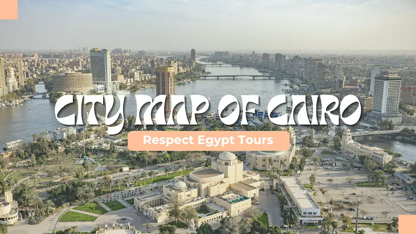
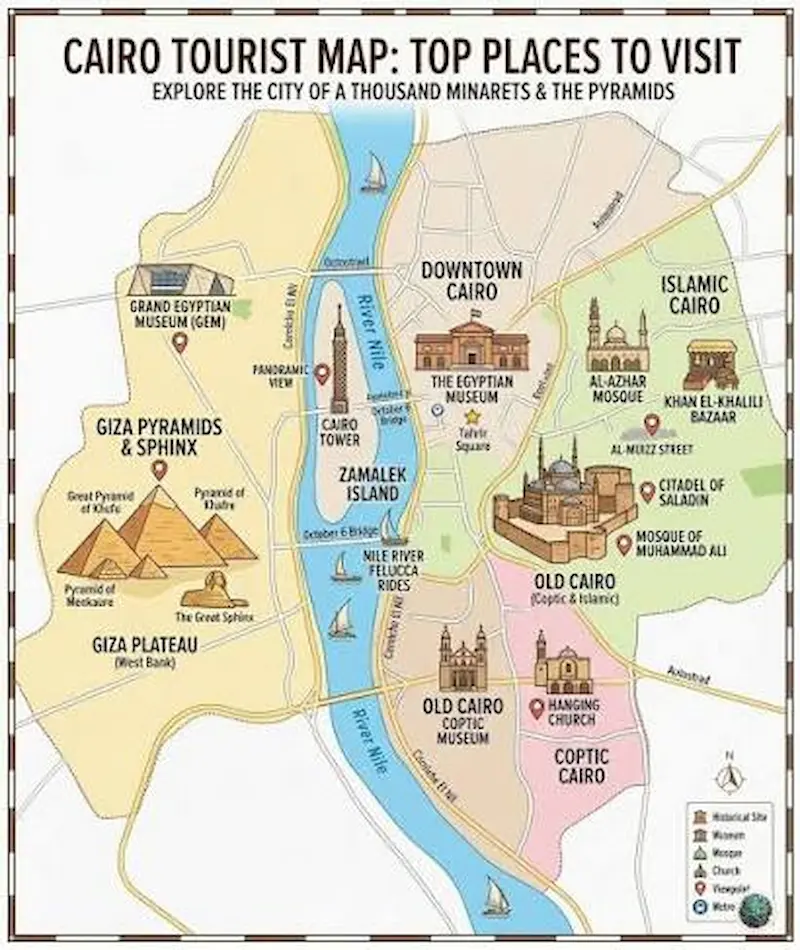
Cairo’s division into several principal districts results in each having distinctive functions and identities.
-
Downtown Cairo: Serves as a commercial and administrative centre, featuring hotels, government buildings, and business centres.
-
Giza: The world knows Giza for its historical archaeological sites and monuments, and it is on the western bank of the Nile.
-
Old Cairo: A repository of both the religious and historical heritage of ancient civilizations.
-
Islamic Cairo: Contains centuries-old architecture, markets, and mosques.
-
Zamalek: Represents a contemporary cultural and residential district that is on an island in the river.
Islamic Cairo contains centuries-old architecture, bustling markets, and historical mosques. To blend in with locals while navigating these traditional neighborhoods, it helps to learn how to say Cairo in Egyptian Arabic like a true Cairene.
Downtown Cairo and Zamalek feature vibrant commercial centers, art galleries, and upscale dining. Selecting the best boutique hotel in Cairo within these central areas places you right at the heart of the city's top landmarks.
🏛️ Key Attractions and Cultural Landmarks
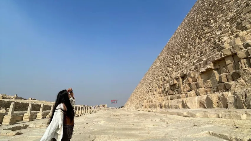
Cairo is one of the most renowned places of culture and history around the globe. The Giza Plateau remains the most frequented tourist attraction, drawing millions of tourists each year.
The Egyptian Museum showcases thousands of artifacts that date back to early Egyptian civilization, providing an insight into the history of the dynastic period and the evolution of civilization.
Other significant areas include traditional markets, historical streets, and sacred landmarks scattered across different parts of the city center.
🚇 Transportation and Mobility in Cairo

Transport in Cairo is extremely active because of the city’s enormous population. The metro is the quickest method to travel between the important districts and also helps to reduce travel time in congestion-ridden areas.
Traffic on roads can be a lot, particularly during peak times, and this makes route planning crucial for everyday movement. Many people and tourists make use of an amalgamation of metro, taxis, and ride-hailing services.
Cairo International Airport connects the city with international destinations, making it an important gateway that is ideal for international travel. Many people and tourists make use of an amalgamation of metro lines, private taxis, and ride-hailing services. If you are exploring the capital on your own, reading a dedicated Cairo Egypt women solo travel guide offers valuable tips on safe transit and local customs.
📥 How to Use a Map of Cairo Egypt for Smart Travel Planning
Modern travelers rely on offline and digital navigation tools while exploring Cairo. Offline maps are especially helpful because of the lack of connectivity in certain areas.
Digital navigation apps provide live updates on transportation routes, traffic patterns, and tourist destinations. Maps printed on paper are still useful for quick referencing and planning.
Using multiple navigation tools will ensure greater accuracy while moving through different areas of the city. Enjoy a Cairo itinerary in 3 days.
🧠 Why does Cairo’s location matter historically?
The location of Cairo in its location along the Nile River has shaped its growth over hundreds of years. The river brought water, fertile land, and trade routes that aided the earliest civilizations.
This unique advantage made Cairo the central point for trade, agriculture, and government in the early days. It continues to serve similar roles in the present time.
The geography of the city was and is one of the major capital cities within the area.
🧳 Practical Travel Tips for Visitors
Travelling in Cairo is a must because of its enormous size and traffic conditions. Exploring only one area at a time is advisable to prevent long travel delays.
Using metro lines with quick taxi rides is typically the most efficient method to navigate through the city. Preparing routes in advance can help make life easier and less stressful.
Downloading the offline map prior to arriving will ensure smooth navigation even if you don’t have an internet connection.
Preparing your routes in advance can help make life easier and less stressful. If you're visiting during the winter months, checking the weather in Cairo Egypt in February will help you pack the right clothing for cool evening Nile breezes.
🏁 Conclusion
Cairo is much more than just a capital city. It is a huge living metropolis that geography, history, and culture have formed. Understanding the structure of its map is essential to exploring Cairo effectively.
Each version helps you understand how the city arranges itself along the Nile, whether you seek a Cairo, Egypt world map, a Greater Cairo map, or an accurate urban map of Cairo, Egypt.
From ancient pyramids all the way to modern areas, Cairo remains one of the most intriguing and intricate cities around the globe to explore.
Related Tours












.png "Movenpick Hotel")





.svg)
 Transfers