
Ancient Map of the Nile: Unlocking Egypt's Forgotten Geography
The ancient civilization of Egypt developed because of the Nile River's geographical features. "Nile" was not merely a river for them; "Nile" meant agriculture, communication, trade, spirituality, and civilization itself. The statement "ancient map of the Nile" signifies much more than geographic knowledge, encompassing ancient philosophy, governance, daily rituals, and ancient Egyptian life itself. This blog will discuss the ancient map of the Nile and how it shaped both Egypt's and the world's worldview in ancient times.
The Ancient Map of the Nile: From Sacred Source to Eternal Sea
As the longest river in the world, the Nile stretches for over 6600 km and comprises two key tributaries: the Blue Nile and the White Nile. The White Nile starts in East Africa's Great Lakes Region, while the Blue Nile begins in Ethiopia's highlands. Both these rivers join in modern-day Sudan in Khartoum, forming the Nile that flows Northwards into Egypt and ultimately ends in the Mediterranean Sea.
In ancient Egyptian cosmology, people believed the source of the Nile to be divine, emanating from a spring beneath the earth or a spring in the heavens guarded by deities. Egyptians did not trace their African course; rather, they paid attention to the portion running through their land. An ancient map of the Nile would often start at the First Cataract by Aswan, which was viewed as the southern border of the known world, and included the expansive and richly fertile Nile Delta as the endpoint. The journey from cataract to sea was sacred and symbolically illustrated how Egyptians perceived life, death, and the perpetual cycle.
Comparing Nile Maps: Ancient Symbolism vs. Modern Precision
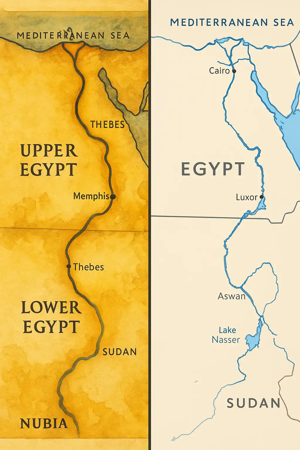
Vertical Orientation and Symbolic Meaning
Ancient Egyptian maps maintained the ancient south-to-north flow of the Nile, placing Upper Egypt at the bottom and Lower Egypt at the top. This arrangement was more than geographic and had rich meaning attached to it. Upper Egypt is where life started, while reaching the delta was abundant in resources. Tomb layouts, religious scrolls, and temple blueprints reflected this orientation and held spiritual significance.
Geographic Scale and Representation
Unlike modern cartography, which uses accurate coordinates and scales, ancient Egyptian maps neglected accuracy in favor of relationships and meaning. Temples, cities, and sacred places were mapped out according to their significance. A temple would appear large on a map if it were a religious center. While this approach is technically inaccurate, it protected social and spiritual geography. Today, we know from satellite comparisons that these maps portrayed the layout of river bends, major cities, and valleys with remarkable accuracy.
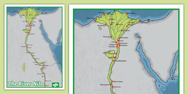
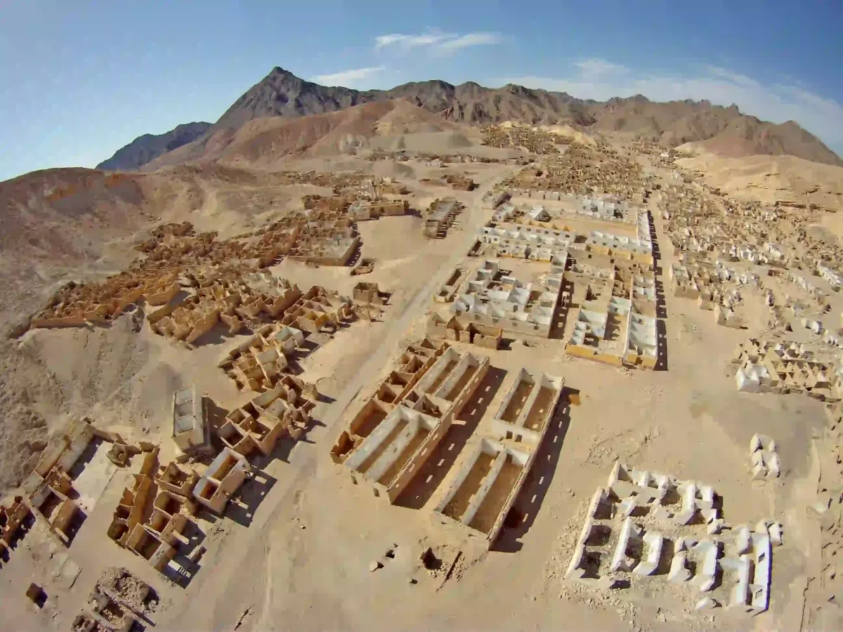
Ancient Nile Maps and Major Egyptian Cities
The Nile was Egypt's first urban planner. Settlements grew linearly along the riverbank for ease of access to water for agriculture and transportation. Cities such as Thebes, Memphis, Edfu, and Elephantine were located strategically to control trade routes, contain temples, and store grain. The architecture of these cities reflected the rhythms of the Nile and their solar and river cycles.
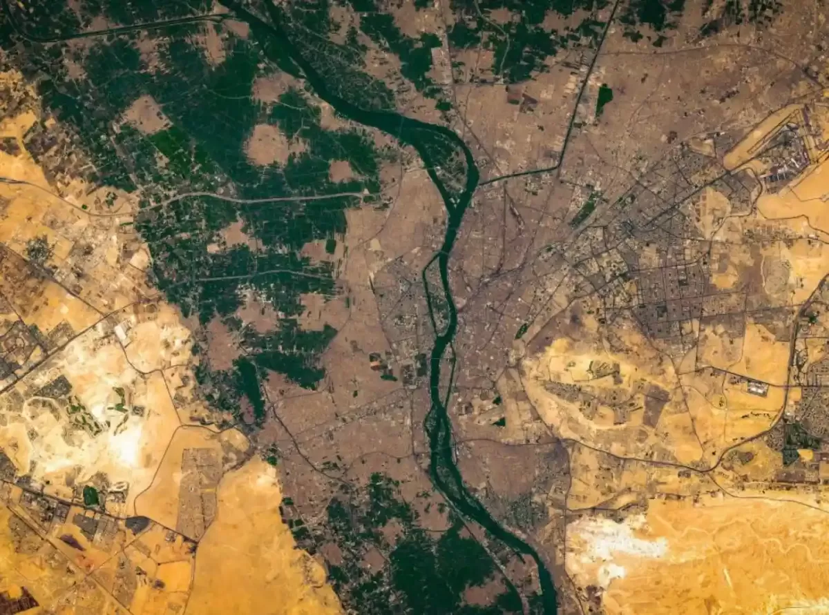
Even today, major cities like Cairo and Luxor depend on the river for agriculture and daily activities. What the ancient map of the Nile depicted symbolically with markers and iconography, modern urban planning continues to affirm. For tourists, this translates into exploring a living history where past and present intertwine through waterways.
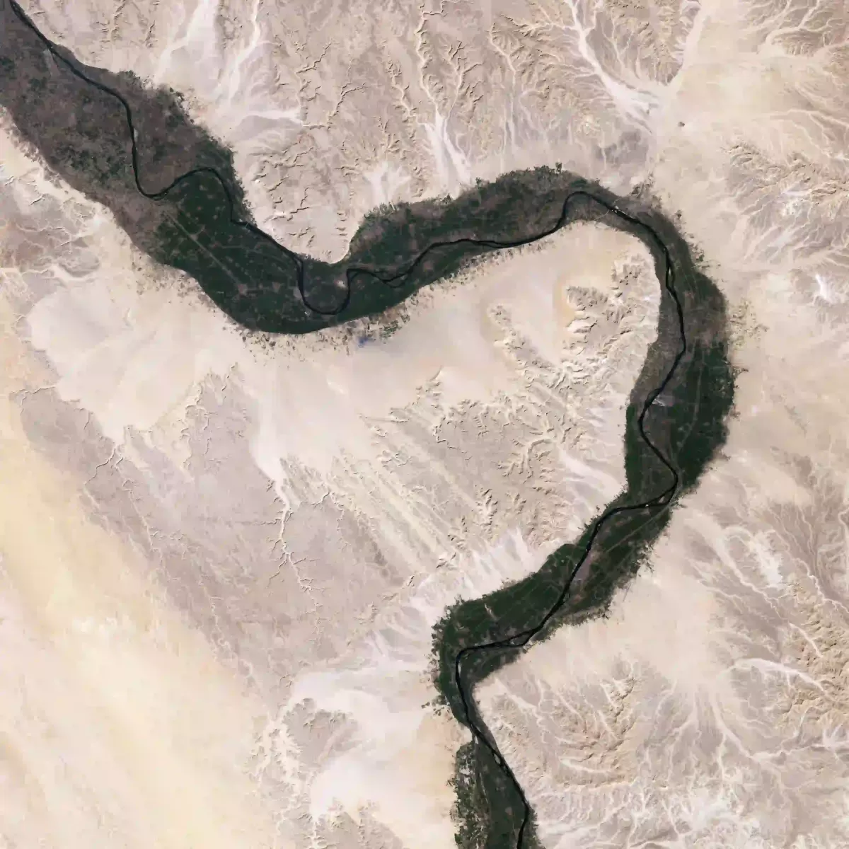
Map of the Nile Delta: Ancient Complexity and Modern Clarity
The Nile Delta was a domain of enigma, influence, and endless evolution. The Egyptians illustrated it in fans, serpentine, or petal shapes, showcasing chaotic bounty. It included noteworthy cities like Tanis, Mendes, and Bubastis, which were sophisticated centers constructed on unstable soil.
Now, the map of ancient Egypt Nile delta is paired with satellite imagery revealing ancient distributaries, cities, and floodplains that lay hidden. Some of these findings corroborate myths of symbolic representations on temple walls and scrolls. Though lacking precision, ancient cultures praised the Delta and its strategic importance for reaping benefits in metaphors based on geography.
Sacred Flow: The Vertical Structure of the Nile River
A river of life to the Egyptians, the Nile was defined coherently as 'the spine of the world. The south-to-north orientation of the Nile facilitated real journeys and the metaphysical odyssey of the soul towards release. Mortuary scrolls depicted soul journeys showing ascent from the south (life) to the north (afterlife), metaphysically embodying rebirth.
This comprehension of geography informs temple construction, ritual practices, and administration. The ancient map of the Nile was intricately woven into its flow. The temples of Upper Egypt are now aligned with the flow of the river and thus serve as architectural aids to the sacred Nile path.
Color in Cartography: Yellow and Green in Nile Mapping
Ancient Egyptian maps used colors purposefully. Yellow delineated areas of deserts, dangerous regions, or divine spaces. Abundance, prosperity, and protection were depicted by green. Such a color palette does not serve an aesthetic purpose; it narrates the regions of farming, settlement, and worship.
A warning advised travelers to be cautious in depictions of the Yellow Nile's edges where it borders the desert. Sacred scrolls often juxtaposed order (Ma'at) and chaos (Isfet), highlighting boundaries using opposing colors. The mural and temple floor decoration with green symbolizing the rich banks of the Nile reaffirmed divine endorsement.
The Nile has Built Map: Sacred Geography in Temples
The Egyptians did not build the temples of Egypt haphazardly. They each embodied geography, theology, and sovereign power. In Abydos, Dendera, Karnak, and Edfu, spatial orientation followed the lift of the river. Spiritual basins, mirrored tributaries, gates marked cosmic boundaries, and altars greeted the sunrise over the river.
Like modern maps, priests used temple layouts as navigational tools. During festivals, pilgrims traversed spiritual "routes," re-enacting the gods' journeys along the river. Ancient artisans not only engraved the ancient map of the Nile upon papyrus, but also embodied it architecturally in stone.
Guardians of sacred territory, the Uraeus and the Nile
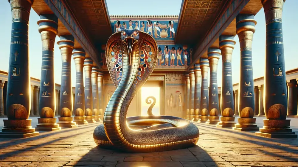
The Uraeus, a Pharaonic crowned cobra, symbolized the goddess Wadjet. She was both the goddess of Lower Egypt and the guardian of the Nile Delta. While serving as an emblem of royalty, the cobra was also a boundary symbol of spirituality and safe passage through riverine regions.
Ancient scrolls and monuments commonly depicted the Uraeus with waterways or at the limits of dominion control. It served as a divine GPS reference point. His location on the ancient map of the Nile River showed where power, sanctity, and peril converged.
Rediscovering Ghost Cities and Vanished Tributaries
Ancient maps have long hinted at the existence of certain cities, which modern technology is now confirming. Mythical cities thought to only exist in folklore are being excavated as LIDAR and satellite scans are revealing them. Concealed settlements in the White Nile and Blue Nile regions are being uncovered beside ancient fork points.
The eastern delta of Egypt and the Fayoum region have revealed some cities mentioned in scrolls or temple inscriptions. With these revelations, the ancient map of the Nile held lost information wrapped in metaphor, memory, and solemn topography. Now, historians seem symbolic maps as credible sources of historical research.
The Serpent Shape of the River: Map Metaphors in Ancient Egypt
One of the most crucial symbols in Egyptian mythology, the snake, took the form of the Nile River, which "curl" shape echoed the serpentine figure of Mehen, the cosmic snake. Mehen was known for guarding the sun god during his nightly journeys. This was more than just a coincidence.
As for the boundaries of land and rivers, snake shapes were used to define sacred boundaries. Temples used these metaphors in layout, and artists drew the Nile with serpent heads depicting divine awareness. Geography, religion, and artistic vision all blended into one system.
Nile Cruises: Experiencing the River as the Ancients Did
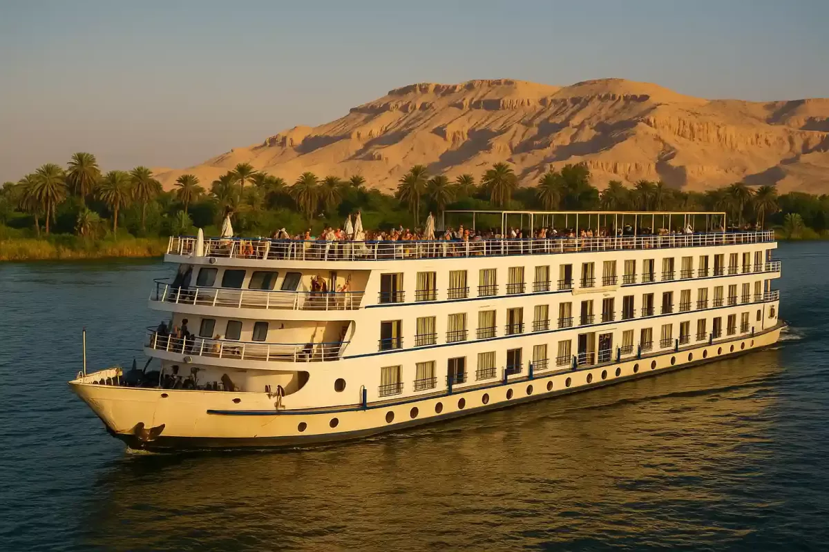
Few modern experiences encapsulate the idea of the ancient map of the Nile quite like a Nile Cruise. These river trips enable modern tourists to traverse the journey made by merchants, priests, and even pharaohs. The cruise, which embarks from Luxor to Aswan, passes by temples and tombs alongside rural life that is still governed by the gentle hands of the river.
On board, you see how empire, faith, and architecture intertwine with geography. Each stop along the cruise, whether it's the Valley of the Kings or Kom Ombo, adds a further layer to the story of Egypt and the Nile. For those keen on ancient geography and culture, a Nile cruise is far from just an indulgent escape; it's an escapade through time. Get your tickets now through Respect Egypt Tours Nile Cruises to experience the map.
Conclusion: The Eternal River of Egypt
The ancient map of the Nile depicts more than just an area of land. It is a heritage of spiritual, political, and agricultural wisdom that is passed down through the ages. With their vertical layouts, symbolic scales, and color-coded logic, the ancient maps of the Nile captured truths about geography, spirituality, and society — truths that remain pertinent even today.
From the grand origins of the Blue Nile and White Nile to the bountiful Nile Delta, and from secret cities to cosmological temples, these maps illustrate how the Egyptians envisioned their world. Respect Egypt Tours invites traverse the river of history, where every bend reveals a tale and every village represents a captured moment in time.


.png "Movenpick Hotel")


.svg)
 Transfers